In early 2019 whilst researching some information concerning 19th century emigration to New Zealand I came across the letters of Charlotte Godley.[*] The letters sent to her mother cover the period 1850 to 1853 and are a record of her time in New Zealand. Charlotte’s husband John Robert Godley had been the guiding force in establishing the Canterbury Association, formed in March 1848 with the purpose of establishing a new colony in New Zealand. On his appointment as the Association’s resident chief agent Charlotte sailed with him and their two year old son, Arthur, on the Lady Nugent to New Zealand arriving in March 1850.[*]
I read the letters with interest and I was quickly captivated by their vivid and witty descriptions of life in the early days of colonial settlement. On reaching New Zealand the Godleys spent six months in Wellington, which was already established as a colony, and in November they left for Port Cooper (Lyttelton) to meet the arrival of the ships bringing the first settlers of the Canterbury Association. The transfer from Wellington was by sea on board HMS Acheron under the Command of Captain John Lort Stokes who with his crew had been tasked by the Admiralty with a full hydrographical survey of the coast of New Zealand. In her letters Charlotte mentions the help given to them by the crew of HMS Acheron and how sorry they were when the ship left to carry on with the work of the survey.
‘We liked most of the officers very much. There was a very nice middy too of about seventeen, Mr Pendar (sic) from Falmouth, who made great friends with Arthur, and gave him a ball, and a whole set of signals, such as they use on the signal flagstaff at Wellington, made in wood by the ship’s carpenter.’[*]
The comment about Mr Pendar of Falmouth immediately drew my attention and as I am a volunteer at the Bartlett in the National Maritime Museum Cornwall at Falmouth my interest was caught enough to try to find out more about this ‘very nice middy’.
The search led me much further than I had first anticipated. The ‘middy’ was Daniel Pender who was descended from seafaring families on both sides and in tracing him throughout his own naval career I was taken on a considerable journey. Initially this involved maritime Falmouth in the late 18th century, especially the Packet Service, operated first by the Post Office and then by the Admiralty. From there the search led to the Royal Naval Hospital School at Greenwich in the 1840s and to details of naval service during the Crimean War. Then on to the Hydrographic Service of the Admiralty which in the 19th century undertook the enormous task of surveying and charting the waters of Britain and its empire. It was in this service that Daniel Pender spent his naval career beginning with the survey of the coast of New Zealand and later making a vast contribution to the survey of the coast of British Columbia and Vancouver Island and eventually becoming Assistant Hydrographer to the Admiralty.
Mr Pender of Falmouth
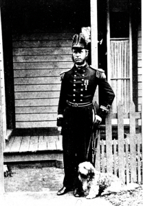
Daniel Pender RN pictured in Esquimalt, Canada in the 1860’s
Royal British Columbia Museum Archives (BC Archives)
Daniel Pender was born on 3rd October 1832 in Falmouth and baptised in the church of King Charles the Martyr in Falmouth on 14th December 1832. His parents were Daniel and Mary (nee Hayes) Pender who had married in Gerrans on the Roseland near Falmouth in 1831. His background was closely connected with seafaring and it is not surprising that he became an officer in the Royal Navy but also an important member of the Admiralty’s Hydrographic Service.
Falmouth had received its Charter of Incorporation from the Crown in 1661 which recognized the importance of both the town and its associated port. In 1688 Falmouth became an important Packet station and as a result grew to be one of the foremost ports in England in the 18th and 19th century.
The Packet Service
The Post Office Packet Service was a branch of the Royal Mail established to carry international mails and government dispatches and the sea links were an important part of the service. Falmouth has a deep estuary with good shelter and anchorages located at the south western approaches to the British mainland. As a result the new town of Falmouth was chosen as the terminus for the new service, initially serving Spain via Corunna and then Portugal via Lisbon and by 1705 there was also a regular service to the West Indies and the Americas.
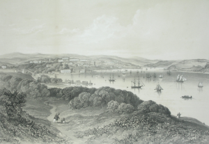
View of Falmouth harbour in the 1830s
Unknown artist (Falmouth Art Gallery)
The Falmouth Packet Service was a civilian service under the control and management of the Post Office with each packet ship having a Commander, Sailing Master, Surgeon and crews, depending on the packet route, ranging from eighteen to thirty men in peacetime, rising to up to sixty men in wartime. At its height the service employed over 1,200 seamen.
In 1823 control of the Falmouth Packet Service was transferred to the Admiralty and command passed to the Royal Navy. Gradually sailing vessels were replaced by steam packets and by 1850 the packet service at Falmouth was in its final stages and with the return of the Seagull from Rio de Janeiro on May 2nd 1851 the service came to an end.[*]
Daniel Pender’s grandfather was Peter Pender of Falmouth, the Master of the Westmoreland a ship hired to the Post Office Packet Service mainly employed on the routes to North America and the West Indies. He is recorded as such in a prisoner exchange between France and Britain in a document of 13th June 1800 after the Westmoreland was taken by a French privateer in December 1799 whilst in-bound from the West Indies.[*] Masters or sailing masters were the navigating officers who often advised the commanders on the handling of ships and in the Packet Service regularly took command in the absence of the commander.
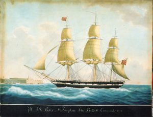
His Majesty’s Packet Walsingham,
Nicholas Cammillieri 1773?- 1860, Watercolour, NMMC
Daniel’s father, also Daniel Pender was born in Falmouth in 1803 and also became an officer in the Packet Service although by April 1823 control of the service had transferred to the Admiralty. Therefore when Daniel Senior was promoted to Master of the packet brig HMS Renard (also on the North America and West Indies routes) in February 1834 he was a serving member of the Royal Navy.[*] HMS Renard was commanded at the time by Lieutenant George Dunsford and served on the North America and West Indies routes.
The North America route was direct and return to Halifax. Ships left Falmouth on the first Wednesday of each month with voyages for the round trip usually taking nine weeks. The West Indies run included Barbados, St Lucia, Martinique, Dominica, Guadaloupe, Antigua, Monserrat, Nevis, St Kitts, Tortola and St Thomas. Daniel Senior was subsequently appointed as Master of HMS Hope, another packet, on 20th February 1837. He appears to have died intestate in 1840 as recorded by the Death Duty Registers of that year which cites Mary as his wife.[*]
Mary Pender (nee Hayes) was also from a seafaring family in Portscatho. Her father, Stephen, was a ship owner and three of her brothers, Edward, George and Richard, all going to sea in the Merchant Service between the years 1817 to 1826, became Master Mariners.
Daniel was the eldest child of Daniel and Mary to be followed in 1835 by Henry and by Mary Hayes in 1837. In the 1841 Census Mary is recorded as living on independent means in St Mawes with her three young children. However by the 1851 Census Mary was listed as a naval widow living in Porhan Lane in Falmouth with her younger son Henry and daughter Mary and with another naval widow as a lodger.
The Royal Naval Hospital School at Greenwich
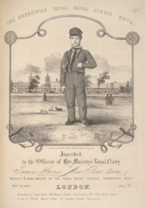
Sheet music of a composition by the Band Master of the Royal Naval School, Greenwich
The music published in 1843 the cover depicts the school and the uniform worn by the pupils.
(British Library Online Gallery)
In about 1843 Daniel had been admitted as a pupil at the Royal Naval Hospital School at Greenwich.[*] His brother Henry was admitted there in 1846. The Royal Hospital for Seamen at Greenwich was established by Royal Charter in 1694 and in 1712 the Greenwich Hospital School was set up as part of the institution to provide assistance and education for the children of seamen, especially orphans.
By the early 19th century candidates for admission to the Upper School were the sons of officers or men of the Royal or Merchant Navy ‘who had attained ten years and not exceeded eleven years and who were able to read fluently, write small text well and to work the first rules of arithmetic with facility and accuracy’.[*] The school provided the boys with a good general education in ‘the usual subjects’ which included English and Mathematics alongside naval training and boys graduated into the navy or were apprenticed in the merchant service.
By 1841 there was the opportunity for some pupils of the Upper School to be selected by examination for specialised training in the Nautical School at Greenwich then under the Headmaster Edward Riddle FRAS, author of A Treatise on Navigation and Nautical Astronomy (1821). Those selected, such as Daniel, received professional instruction in mathematics, navigation and nautical astronomy, the use of instruments such as the sextant and the azimuth compass, chart drawing and marine surveying. They were trained to attain the naval rank of Master as professional seamen and specialists in navigation and were externally examined by Trinity House.
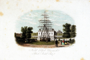
the Block Model Ship ‘Fame’ at the Naval School, Greenwich.
(National Maritime Museum, Greenwich)
In 1789 the corporation of Trinity House had established a special committee of four Elder Brethren to carry out examinations for masters in His Majesty’s Navy ‘it being essentially necessary that all officers who undertake charge of His Majesty’s ships and vessels of every description should possess a competent knowledge of navigation for that purpose’.
On leaving the Nautical School for the Royal Navy or the Merchant service all boys were given a chest, bedding, clothing and drawing instruments. Also the government of the day awarded eight Master’s Assistant-ships in the Royal Navy annually and an outfit equivalent of £20 to boys from the Nautical School who had achieved a high standard.[*] Daniel was one such pupil and is listed by the United Services Magazine of 1847 as being appointed as Master’s Assistant to HMS Acheron which sailed from Plymouth on 21st January 1848 to undertake the survey of the coast of New Zealand.[*]
Masters in the Royal Navy
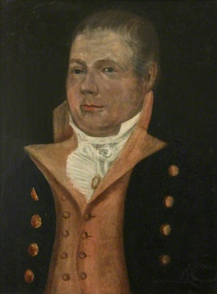
Master H. Roberts Osborn, RN c1830-1840 wearing the uniform of a Master in the Royal Navy.
Unknown artist. National Maritime Museum, Cornwall (NMMC)
Daniel was in the first stage of a career as a Master in the Royal Navy. Masters were professional seamen with the particular responsibility for navigation in regard to a vessel and reported directly to the Captain. Their role was to ensure that a vessel was sailing effectively and this involved the plotting and charting of routes and taking the ship’s position on a daily basis. The Master also supervised the taking of observations, made entries in the official log and kept his own logs regarding position and weather conditions and ensured the maintenance of the compass and other instruments. On sailing ships he was also in charge of the maintenance of ropes, rigging and sails and most importantly in setting the sails. As Admiral Erskine stated in a debate in Parliament in 1866, ‘The most difficult duty of masters was not to be learnt in a day, in fact required almost a lifetime’.[*] Masters were also able to command vessels in non-combatant situations and were vital to navigation.
Originally the rank of Master was that of Warrant Officer and Masters were appointed by the Navy Board but by 1808 they were given similar status to commissioned officers when they were granted wardroom rank. By 1843 they were given commissioned status and in 1867 the Navy reorganised this part of its structure into the Navigating branch with new pay scales and ranks. Masters, Second Masters and Masters Assistants became Navigating Lieutenants, Navigating Sub Lieutenants and Navigating Midshipmen respectively. Senior officers were appointed as Staff Commanders and Staff Captains.
Daniel Pender began his naval career as Master’s Assistant on the survey vessel HMS Acheron in 1847 and as part of the Navy’s Hydrographic Service. He passed his Master’s examination on 24th October 1853, becoming a Second Master in 1853,[*] Master in 1859 and Staff Commander in 1869. He retired as Captain in 1884. Throughout his career he had served on a wide variety of size and type of ships all engaged in specialised survey work and when he retired he was Assistant Hydrographer of the Navy.[*]
The Hydrographic Service
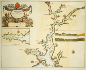
Chart of Falmouth from Great Britain’s Coasting Pilot c1693.
Captain Grenville Collins (Grenville Collins)
The first comprehensive survey of the coastal waters of England and Scotland Great Britain’s Coasting Pilot was published in 1693 by Captain Greenvile Collins, who styled himself as Hydrographer in Ordinary. Collins had a distinguished career in the navy and had gained the attention of Charles II for the surveying work on various voyages he had undertaken and in 1681 he was able to gain royal support for a programme of surveying which provided accurate and comprehensive charting of British waters. Over the next hundred years as the importance and influence of the British Navy grew so too did the need for new charts of overseas waters and therefore the need for a distinct and specialised hydrographic service.
The result was the establishment of the Hydrographic Office of the Admiralty in 1795. Alexander Dalrymple F.R.S. was the first Hydrographer to the Admiralty appointed to the post created at the same time by the Board of the Admiralty by an Order in Council. It was intended that the Hydrographer would supply charts to the Royal Navy and Dalrymple was given the task of organizing and cataloguing the Admiralty’s existing survey material. The first chart of Quiberon Bay was supplied in 1800 and there was publication of Sailing Directions and Notices to Mariners.
Dalrymple remained in office until 1808. He was succeeded by Thomas Hurd, a captain in the Royal Navy and an experienced hydrographic surveyor with an interest in science and connections with other specialists who were scientifically orientated such as Captain Matthew Flinders, Captain Francis Beaufort and Captain John Franklin. During Hurd’s time in office the surveying service of the Royal Navy came under the direction of the Hydrographer and Hurd established the principle that ships deployed for hydrographic purposes should be manned by specialist survey officers, skilled in navigation and pilotage. Hurd was followed as Hydrographer in 1823 by the noted Artic explorer Captain William Parry who encouraged reciprocal co-operation with other hydrographic services especially those of Denmark, France and Spain.
In 1829 Captain Francis Beaufort was appointed and as the need for systematic surveying and charting of navigational importance grew the activities of the Hydrographic Office increased. The Hydrographic Office became an Admiralty department in 1831 and by 1855 the Chart Catalogue listed 1,981 charts with 64,000 copies issued to the Navy. Beaufort was responsible for the development of the scale for wind strength and the publication of Official Tide Tables and for the direction of voyages of exploration such as the survey of South American waters by Captain Fitzroy in HMS Beagle (with Charles Darwin as part of the expedition) and the search for Sir John Franklin’s lost Arctic expedition.
During the nineteenth century the surveying and chart producing skills were refined and the Royal Navy provided a specialist and professional core of survey officers and naval vessels to support those tasks. At that time the Hydrographic Office itself was a relatively small organization with an office at the Admiralty in London.
During the twentieth and twenty first century the organization developed much further. In 1941 during World War II chart printing was moved to offices in Taunton, Somerset, in 1953 the Navy commissioned the first purpose built survey vessel and in 1968 the compilation staff were also transferred to Taunton. With various developments, commitments and technical innovations a new structure was required and in 1994 the Hydrographer of the Navy became the Chief Executive (still a senior naval officer) of the United Kingdom Hydrographic Office now an agency of the Ministry of Defence.
The Office has new headquarters in Taunton with over nine hundred staff and provides hydrographic and marine geospatial data not only to the Royal Navy but also to mariners and maritime bodies throughout the world and makes an important international contribution to maritime safety and knowledge.[*]
It was not surprising that given his educational background in the Nautical School at Greenwich that Daniel Pender was appointed as a Master’s Assistant in the Royal Navy and was attached to the Hydrographic Service in 1847 on board HMS Acheron. During his naval career Daniel remained with this specialised branch and many of his fellow officers entered this branch by the same route and initially from the same rank.
HMS Acheron and the Survey of New Zealand
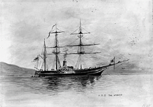
HMS Acheron in New Zealand waters.
Unknown Artist. The Alexander Turnbull Library, National Library of New Zealand.
HMS Acheron was a Hermes class barque rigged wooden paddle steamer of the Royal Navy of 700 tons and with an engine which could develop up to 170 horsepower. By the 1830s steam was becoming acceptable as a means of propulsion for some vessels and the ship was originally built by the dockyard at Sheerness to carry mails. By 1847 she was refitted for hydrographic work for the Royal Navy and commissioned to survey the coast and harbours of New Zealand. Although Captain Cook had undertaken the first survey of New Zealand, with the increase in European, mainly British, settlements from the 1840s the need grew for more extensive and up to date navigational information to support the growing communities. The Hydrographer of the Navy, Francis Beaufort, selected the Acheron for the task under the command of Captain John Lort Stokes and it was for this ship that Daniel Pender received his first posting in the Royal Navy.
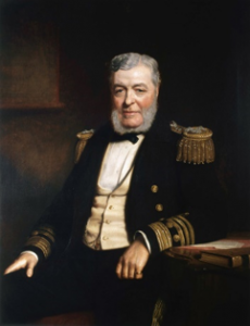
Admiral John Lort Stokes (1812-1855) by Stephen Pearce.
(National Maritime Museum Greenwich)
Captain Lort Stokes had spent most of his naval career in surveying and charting waters in various parts of the globe, including many years on the surveying ship HMS Beagle.[*] During that time he had served under Captain Fitzroy, accompanied by Charles Darwin, whilst Beagle was engaged in surveying the southern parts of South America and undertaking a circumnavigation of the globe. Later, as a Lieutenant, he took command during the surveying of an extensive part of the Australian coast. He returned to England in 1843 and recorded an account of his Australian voyage in Discoveries of Australia which was published in London in 1846.[*] In July 1846 he was promoted to Captain and in October 1847 he was appointed to HMS Acheron to undertake the full hydrographical survey of New Zealand.
The ship sailed from Plymouth in January 1848 for four years of surveying duties, calling at Rio de Janeiro, the Cape of Good Hope and Australia and arriving at Auckland in New Zealand on 7th November of that year. It was the first steamship in New Zealand waters and the Captain was enthusiastic about the advantages of steam in hydrographic work as soundings could continue whether conditions were calm or the wind was in the wrong quarter. However the expedition was an expensive undertaking as the steam engines were powered by coal and this coal had to be shipped from New South Wales in Australia.
Captain Lort Stokes commanded a crew of one hundred which included a number of other experienced hydrographers who were to have a considerable influence on Daniel Pender in his future career. Captain George Richards, who was born in Antony in Cornwall and had joined the navy at the age of twelve, was second in command of the expedition and Frederick Evans, was the Master and both were later promoted to the post of Hydrographer of the Navy. Frederick Evans also had considerable artistic talent and illustrated various scenes from the expedition. He was also the officer who was directly responsible for the supervision and further training of Daniel Pender, appointed as Master’s Assistant. The Chief Surgeon, Dr David Lyall was a distinguished botanist, who had served with Sir J D Hooker on his expedition to Antarctica and with Sir James Clark Ross of the Erebus and the Terror and the Assistant Surgeon, Dr Charles Forbes, was a capable geologist. Daniel was to serve alongside many of these men in much of his later career.
The survey undertaken by HMS Acheron was the first official survey of the New Zealand coastline and the region had not been systematically charted since the voyage of Captain Cook in 1769.[*] By the 1840s a number of settlements had been established by the New Zealand Company and others were to follow bringing more and more emigrants largely from Britain. Indeed Charlotte Godley, who encountered Daniel Pender on the Acheron, had come to New Zealand with her husband John who was appointed as chief agent of the Canterbury Association to establish a settlement at Canterbury and they lived for two years at Lyttelton and Riccarton. With the growth of settlements and population and the development of trade it became important to have a detailed coastal survey to identify safe havens and anchorage for both passenger and trading vessels. HMS Acheron arrived in New Zealand waters at Auckland in 1848 and the survey began with Waitemata Harbour moving on to Wellington, Lyttelton and Otago. Cook Straight , the Marlborough Sounds and Nelson coastal waters followed and ended with Foveaux Strait and Dusky and Milford Sounds. In total over 4,300 miles of coastal survey were undertaken.
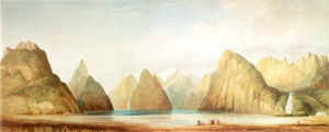
Milford Sound South Island New Zealand.
Watercolour by Frederick John Owen Evans (Master of HMS Acheron and later Hydrographer of the Navy). The Alexander Turnbull Library, National Library of New Zealand.
Captain Stokes was closely involved in the coastal survey and members of his team were sent on detachment to survey various areas of the coast but there were also expeditions to explore inland such as the Canterbury Plains. The Captain inspired admiration and trust from his crew, from the settlers and the Maori population and he was able to help the colonial administration in a number of ways. In March 1851 however HMS Acheron was ordered to Sydney to be laid up as a cost cutting measure, the Hydrographer’s budget had been cut and steam power was expensive. The survey was subsequently completed by the smaller sailing ship HMS Pandora. The first official chart of the New Zealand coastal survey was issued by the Admiralty in March 1856 with further editions in 1861 and 1862. The crew of HMS Acheron returned to England and were dispersed to other ships in the fleet amongst them the Master’s Assistant Daniel Pender.
The Crimean War 1853 – 1856
In October 1853 war started in the Balkans when Russia occupied the Danubian Provinces of the Ottoman Empire. Russia was opposed not only by the Ottoman Empire but by France, Great Britain and Sardinia and the conflict extended from the Balkans to the Crimean Peninsular, the Caucasus, the Black, White and Baltic Seas and parts of the Far East. Great Britain sent the Army and the Royal Navy to the Crimea and by 1854 both services were fully involved in all the theatres of the war. Although the army campaigns in the Crimea came to dominate the collective memory of the war, the navy had a significant part to play. One of the most successful campaigns of the war was fought at sea when the allied navies almost destroyed the Russian fleet at Sevastopol. In the Baltic the allied navies attacked and destroyed the fortress at Sveaborg and threatened St Petersburg whilst there were also squadrons in the White Sea and the Pacific
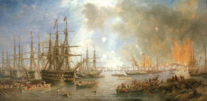
The Bombardment of Sveaborg 1855
John Wilson Carmichael (1799 -1868) – National Maritime Museum Greenwich
By 1853 Daniel Pender had been promoted to Second Master and was serving on HMS Britannia. This was a 120 gun first rate sailing ship of the line launched in 1820 and in service until 1843 when the ship was de-commissioned. She was returned to service for the Crimean War and became the flagship of Sir James Whitley Deans Dundas commander of the Mediterranean and Black Sea Fleet who was in command of the bombing of Sevastopol in support of the siege in October 1854.
Daniel left the ship in March 1855 to join HMS James Watt, also as Second Master. The ship was originally ordered as the sail powered HMS Audacious in 1847 but was renamed and launched in 1853 as a steam and sail 91 gun ship driven by Boulton and Watt steam engines. She saw service throughout the Baltic campaign of 1854–1855 and Daniel served on board from March 1855 until October 1855. From 1856 Daniel was Second Master on HMS Merlin a steam paddle packet boat which had been converted as a survey ship in 1854 and was used as a gun vessel in the latter part of the war.
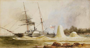
HMS Merlin narrowly escaping destruction of two Russian mines off Sveaborg 1855
John Wilson Carmichael
The Crimean War was the first war to receive comprehensive media coverage. William Howard Russell the Special Correspondent for The Times newspaper was the father of modern war reporting. His graphic eye witness accounts of the military and naval engagements, the conduct and often the abuses of the war and the work of figures such as Florence Nightingale brought to light the realities of the conflict to civilians at home.
Submarine mines were developed and although many ships were still sail powered steam power was used increasingly at what was the beginning of the change in ship propulsion. The use of the telegraph to communicate reports from the front also speeded up the time frame for news and photography, particularly by Roger Fenton and other photographic pioneers, gave greater immediacy and visibility to developments in the war.
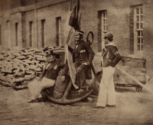
Royal Navy Seamen who had served in the Crimea. Admiral’s Coxswain Charles Brooks. HMS Britannia, Boatswain John Starling, HMS Sampson and Leading Seaman W Pengelly, HMS Sanspareil, posed in Portsmouth with an anchor and Royal Navy Ensign.
Joseph Cundall and Robert Howlett
Imperial War Museum (IWM)
The conflict came to an end with victory for the allies and the signing of the Treaty of Paris on March 30th 1856. The loss of life on both sides of the conflict was enormous but the greatest loss was due to disease which, in Britain, after the peace prompted reform in the conditions of service and care for those serving in the military and the navy. The Victoria Cross was introduced as the highest award for gallantry and campaign medals were awarded to all ranks for their part in the conflict. Daniel was awarded the Crimea Medal and the Baltic Medal for his service.[*]
In May of 1856 Daniel became Second Master of HMS Porcupine under the command of Captain Henry Charles Otter. The ship a wooden paddle steamer was launched from Deptford Dockyard in 1844 as a first class gun vessel and had seen service as such in the war. However with the coming of peace she was converted to use as a survey ship and began an extensive survey of the west coast of Scotland. A number of the charts and soundings recorded by the survey were drawn up by amongst others Daniel Pender. Daniel spent six months as part of the crew and then joined HMS Plumper as Second Master in January 1857.
The Survey of the Pacific coast of North America
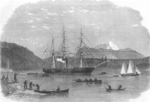
HMS Plumper at Port Harvey, Vancouver Island
From a drawing by E.P. Bedwell
HMS Plumper was a wooden screw sloop launched in 1848 at Portsmouth Dockyard and was the only ship of the Royal Navy built to this design. By 1857 the ship had been converted to a survey ship and was on her third commission with a crew of one hundred commanded by Captain George Richards who was tasked to conduct surveys on the Pacific coast of North America.[*]
A previous survey of the north western coast had been undertaken by Captain George Vancouver in HMS Discovery as part of his expedition of 1791-1795. In the first year the expedition travelled to Cape Town, Australia, New Zealand , Tahiti and Hawaii and in 1792 proceeded to the Pacific coast of North America. The expedition was commissioned to survey the coastline between 30o N and 60o N and established the nature of the waters and the islands. Vancouver Island was named for the Captain and other places after others in the expedition. The expedition did not locate the positions of the Fraser and Columbia
Rivers, major features in terms of navigation but in general the mapping and charting opened up the area for trading and settlement and there were no further British surveys for over fifty years until HMS Plumper was sent to the Pacific coast on her third commission as a survey ship for the Royal Navy.
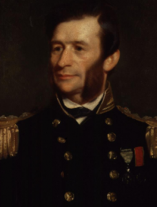
Captain George Henry Richards
Stephen Pearce.
National Portrait Gallery (NPG)
Captain Richards, in command of Plumper, was born at Antony in Cornwall in 1819 and entered the navy in 1832 and was appointed to his first surveying duty in the Pacific two years later on HMS Sulphur. He had an active naval career. He saw duty in the first Opium War with China, was involved in the survey of the Falkland Islands and the south east coast of South America and in military action against the Republic of Buenos Aires. In 1847 he was second in command of the expedition to survey the coast of New Zealand on HMS Acheron and would have come to know Daniel Pender. From 1852-54 he sailed as second in command on HMS Assistance in search of Sir John Franklin’s lost Arctic expedition and also surveyed the coast of the Canadian Arctic making a remarkable sledging journey of over 2,000 miles.
HMS Plumper left Plymouth in March 1857 under Richards command. He was accompanied by a number of men who would later become senior figures in naval hydrography, including Richard Mayne, Edward Parker Bedwell, John Ewing Gowlland and Daniel Pender. The ship arrived at Esquimalt in British Columbia in November.
Esquimalt harbour is on the southern tip of Vancouver Island adjacent to the city of Victoria. In the language of the native Central Coast Salish the name means ‘the place of gradually shoaling water’.
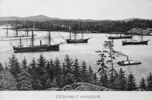
Esquimalt Harbour – home of the Pacific station of the Royal Navy
BC Archives
In 1842 a hydrographic survey of the area was undertaken by HMS Pandora and in 1848 the first Royal Navy vessel was based there to be followed by others from the British Pacific Squadron. In 1854 after the Siege of Petropavlovsk during the Crimean War the navy needed a hospital to take the wounded and sick from the siege and therefore the first shore establishment for the Royal Navy was established there.
After the war ended the nascent naval base grew in importance with the development of the Colonies of Vancouver Island and British Columbia and the need for a comprehensive survey of their waters to be undertaken for both commercial and political reasons. By 1865 the facilities of the naval base were recognised as an alternative to Valparaiso in Chile as home for the Royal Navy’s Pacific Station.
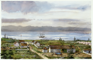
Belle Vue Sheep Farm, San Juan Island 1859 Richard Schlecht National Park Service (US)
The farm, established by the Hudson Bay Company, shown here in 1859, probably with HMS Plumper in the bay. The Farm Diary mentions visits of HMS Plumper and members of her crew, including Daniel Pender
On arriving at Esquimalt the first task for Plumper and her crew was to provide a British military presence on Vancouver Island and to help the senior British Commissioner Captain James Prevost with the Anglo-American Boundary Commission dispute. The naval surveyors were to fix the position of the 49th Parallel where it reached the Pacific coast with their United States counterparts and for this purpose Captain Richards and his team placed a marker on Point Roberts. They then began a survey of the Georgia Strait and the Southern Gulf Islands until this survey work was interrupted by the discovery of gold deposits on the Fraser River when Plumper was sent up the river by Governor Douglas to Fort Langley to assist with keeping law and order as thousands of prospectors, many from California, arrived in Victoria and made their way to the gold fields.
Captain Richards and his crew were not only to maintain the British presence in the area and to provide transportation and manpower but were also tasked with charting the lower reaches of the Fraser River as a matter of urgency as ships were entering the waters ‘knowing nothing of navigation and run considerable risks’.[*] This survey between Vancouver Island and the mainland occupied the next two years with a number of smaller boats setting out each day from Plumper to make detailed maps of the coast and islands. In 1859 the survey also involved mapping and charting of Victoria Harbour. The charts, findings and observations were sent to the Admiralty in London and the Hydrographic Office published the surveys as the Vancouver Island pilot as a first edition in 1861 and a second edition in 1864.[*]
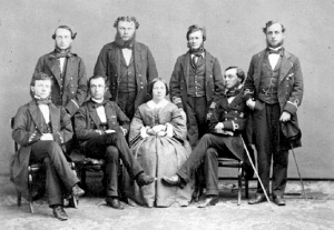
Officers of HMS Plumper
Sitting left to right; Sub- Lieutenant E.P. Bedwell, Second Master Daniel Pender, Mrs. G.H. Richards, first
Lieutenant William Moriaty; Standing left to right; Dr David Lyall, paymaster W.H.J.Brown, Captain G.H. Richards, Lieutenant Charles Mayne. (BC Archives)
Daniel Pender was to spend thirteen years closely involved in all this surveying work and his name appears as draughtsman on many of the charts either solely or alongside the names of other crew members. Wherever possible Captain Richards and his surveyors kept native place names but some places were named for crew members such as Bedwell Sound, Mayne Island, Browning Inlet and Gowlland Point and for Daniel in the form of the Pender Islands.
Captain Richards kept a journal of the circumnavigations and surveys of Vancouver Island as did Second Master John Thomas Ewing Gowlland (educated at the Greenwich Naval School) and Lieutenant Richard Charles Mayne all of which provide a comprehensive and vivid picture of the early years of the survey.[*]
In November 1860 the Master of HMS Plumper John Bull died suddenly at Esquimalt and Daniel was promoted to Master in his place. It had already been decided that a larger, more powerful vessel was necessary for the surveying work and in December HMS Hecate, a wooden paddle sloop fitted out for survey work, arrived at Esquimalt to replace Plumper.
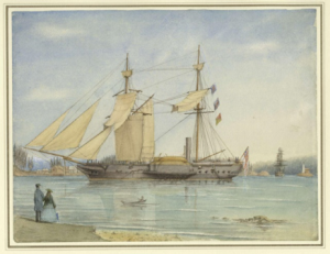
HMS Hecate, Esquimalt, Vancouver Island, E.P.Bedwell, BC Archives
Most of the officers and crew, including the Master Daniel Pender, remained with Captain Richards and for the next two years continued with the task of surveying the Northwest coast in Hecate whilst Plumper returned to England. In 1862 Captain Richards and HMS Hecate was recalled to London and on arrival Richards succeeded to the post of Hydrographer of the Navy. As his senior assistant surveyor, Master (later from 1867 Lieutenant) Daniel Pender was left at Esquimalt to continue the survey of the British Columbia coastline using the hired paddle steamer Beaver.[*]
The Beaver was the first steamship on the Pacific Northwest coast of North America and was in service from 1836 until 1888. The ship was built in Blackwall Yard, England for the Hudson’s Bay Company and designed to be able to travel in both the open and sheltered waters of the Northwest region in order to serve the Company’s trading posts. The ship was a two masted paddle wheel steamer although she was sailed first to Fort Vancouver before the paddles, boilers and engines were installed there.
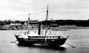
Beaver about 1869/1870 at the end of her time as a Royal Navy survey ship. (BC Archives)
In 1858 -1859 the ship was used to help in asserting British control during the Fraser Canyon Gold Rush and was therefore a natural choice for charter by the Royal Navy to continue the survey work of HMS Plumper and HMS Hecate. Captain Richards was allotted £3,500 for the lease but the Company insisted that the cost would be £4,000. The extra £500 was provided by Governor Douglas, governor of the colony of Vancouver Island and of British Columbia emphasising the importance of the survey both from a political and social viewpoint for the developing territories.
Daniel was attached to the complement of HMS Topaze and was now the commander of Her Majesty’s Hired Survey Ship Beaver with a crew which consisted of four officers, twenty nine seamen and a marine. Acting Master Edward Blunden was his second in command, together with six petty officers who had transferred from HMS Hecate and Dr Edward Bogg who was the assistant surgeon. Other members of the crew were volunteers from Hecate or had been drafted from HMS Topaze.
For the next eight years Daniel and his crew were responsible for recording and charting the western seaboard and islands of British Columbia and surveying many of the river channels and the anchorages as far as the northern boundary of British Columbia. This was a period of challenge for hydrographers which required accurate charts and pilotage information for both those areas already known to surveyors and those which had been previously been unmapped. The introduction of steam propulsion for shipping also required greater accuracy and new requirements for navigational information.
Captain Richards was an experienced hydrographer and tireless in pursuit of excellence in hydrographic work. Those who worked with him followed his example and Daniel and his crew of HMHSS Beaver were committed to producing work of the highest quality. The meticulous survey they undertook, together with the earlier work conducted under Captain Richards, made a significant contribution to the safety of the waters surrounding Vancouver Island and the coastline of British Columbia not only for the Royal Navy but for the rapidly developing commercial and mercantile trade of the region. With properly charted waters the colonies of Vancouver Island and British Columbia were able to develop and grow in importance and in 1871 they became part of the Dominion of Canada.
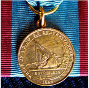
The SS Beaver Medal for Maritime Excellence (Maritime Museum of British Columbia)
The importance of the Beaver, as both a commercial and a naval survey vessel, to the maritime history of British Columbia is now recognized by the award of the Maritime Museum of British Columbia’s SS Beaver Medal for Maritime Excellence. The gold plated medal is made from metal salvaged from the wreck of the Beaver which grounded at Siwash Rock outside Vancouver in 1888. The award is made annually for up to four individuals for outstanding contributions to the marine sector in British Columbia.[*]
Daniel had arrived in Esquimalt aboard HMS Plumper in 1857 and spent the next thirteen years based there. During that time he saw it grow from a basic naval anchorage to become a major naval base and dockyard and the Pacific Station of the Royal Navy. His own naval career also prospered, developing his skills as a hydrographic surveyor and draughtsman, as an administrator and as a commander. He is often mentioned in the memoirs and journals of others who served alongside him such as Captain Richards, Edward Bedwell and John Gowlland and clearly took an active part in the life of Vancouver Island and Victoria.
One of the social highlights of the time which involved Daniel was the visit of Lady Jane Franklin, the wife of Sir John Franklin, who had arrived in Esquimalt in February 1861. In 1845 Sir John had embarked on the Northwest Passage expedition to the Arctic with HMS Erebus and HMS Terror. The expedition had disappeared and Lady Franklin had campaigned continuously to maintain a search from 1848 to 1859. The last search instigated by Lady Franklin under Captain McClintock in the yacht Fox returned in 1860 with clear evidence of the loss of the ships and the demise of the men. Lady Franklin, with her secretary and companion Sophia Cracroft, was invited by Henry Grinnell, who had sponsored the searches, to visit New York and then to make a tour of parts the U.S and Canada. Captain Richards, now in command of HMS Plumper, had been part of the earlier search led by Edward Belcher and was a friend of Lady Franklin.
After an extensive tour Lady Franklin and her companion were able to join the Captain and Mrs Richards, who now accompanied her husband, at Esquimalt. Sophia reported that Lady Franklin was delighted to be ‘once more among our own people only’[*] and they spent over a month in Victoria. She spent time with the wider society of Vancouver Island but also with the officers and crew under Captain Richards command. She was described by Daniel and his fellows as a fine lady, always cheerful and full of life and energy despite the tragedy of her loss.
The work of the hydrographers at Esquimalt was varied and demanding but they also enjoyed an active social life in the developing and growing Colony. The naval base was in winter quarters with ships moored at Esquimalt from November to February or March. The hydrographers spent much of their working time in the shore offices drawing up and refining their charts for ultimate despatch to the Admiralty in London. Daniel Pender’s name appears on many such charts and he would have had a supervisory role over much of the output of the drawing offices. In his position of Master he had considerable responsibilities in command and in keeping records. One such task for the Master of a ship was to record information for the census and Daniel made the entries in 1861 for HMS Hecate.
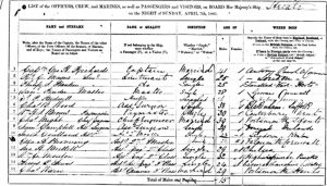
A page from HMS Hecate’s entry for the 1861 Census recorded by Master Daniel Pender on board ship in Esquimalt. Daniel’s name is the fourth one listed. (The National Archives)
In the warmer months the process of surveying and measuring the coastal waters and inlets resumed. This process was undertaken by the main vessel such as Plumper, Hecate under Captain Richards’ command but later by Daniel as commander of Beaver. In many circumstances the command vessel was anchored and surveys of sections of the coast were undertaken by smaller vessels such as the ship’s cutters, gig and whalers with one or two officers and a small number of crew. The days were spent aboard taking soundings and measurements and at night the sailors would camp on shore. John (Jack) Gowlland in his journal recalled that in July 1860 while camping on such an expedition he was joined one evening by Daniel Pender and Edward Blunden from a separate group, to celebrate his twenty second birthday and they enjoyed ‘hot grog and a game of cribbage around the camp fire’.[*]
When the ships were in harbour at Esquimalt and the officers were not on duty they enjoyed a variety of social occasions. There was the Governor’s Grand Ball held at the French Hotel as were numerous formal dinners. The officers often entertained the young ladies of the colony to dances and small dinners on board ship. There were expeditions inland to the various communities that already existed or were being developed and visits to events such as Bees which were the old backwoods custom of celebrating the establishment of farms by new settlers. In winter skating and sledging were popular pastimes and in the summer months horseracing. The ships’ provisions were often augmented by trading salmon, oysters, duck and venison with the local community and commodities such as furs. Daniel, like many of his naval contemporaries of the time and his father before him, joined a Masonic Lodge. In 1861 he joined the Victoria Lodge and in 1866 the Nanaimo Lodge, both in Vancouver Island.[*]
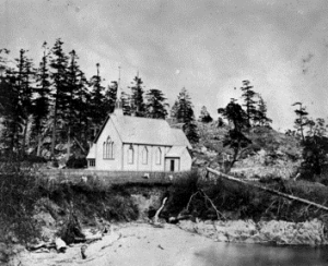
St Paul’s Church, Esquimalt where Daniel was married in October 1869. (BC Archives)
In 1869, towards the end of his time in Canada, Daniel was appointed as Staff Commander and was also married to Amy Maria Gribbell. Amy was born in 1845 in Tavistock. Her brother the Reverend Francis Gribbell had arrived with his wife in Victoria in 1865. By 1869 Francis was the priest in charge of St Paul’s Esquimalt and Daniel Pender had named Gribbell Island in his honour. He was closely associated with the development of education in Vancouver Island, he became Principal of the Anglican Collegiate School in Victoria from 1870-1875. He was also involved in the governance of the Ladies College (Angela College) in Victoria and in June 1869 his sisters Amy and Florence ‘with high qualities and experience’ travelled to Victoria on the ship Gussie Telfer with the aim of teaching at the College. However on 26th October 1869 The Colonist newspaper reported the marriage of Amy Gribbell to Commander Daniel Pender at St Paul’s Church, Esquimalt. In 1870 the same newspaper recorded the birth of their first daughter on 27th August at Beacon Hill Cottage, James Bay, Vancouver Island.
The work of surveying the western seaboard and the islands of British Columbia was now considered to be complete and was the end of this most important phrase of British activity on the coast. Beaver was returned to the Hudson Bay Company and civilian service. In 1874 the Company sold Beaver to the British Columbia Towing and Transportation Company which used the vessel as a towboat until 1888 when she ran aground on rocks in Burrard Inlet near Stanley Park, Vancouver Island. No further hydrographic vessels were based on the Pacific station until HMS Egeria in 1898.
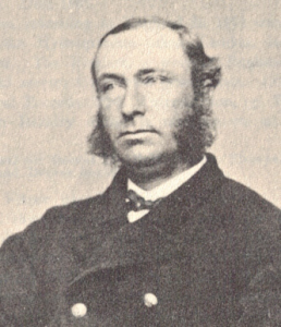
Daniel Pender RN in later life
Daniel Pender returned with his family to England in 1871 and was attached to the Hydrographic Office in London. He worked once again directly under the hydrographer Sir George Richards as his Chief Naval Assistant to publish seventeen major charts, many harbour and inlet surveys and Sailing Directions all based on his fieldwork from Beaver. In doing so Daniel Pender enhanced not only the Royal Navy’s and all seafarers and travellers understanding of the northwest coast of North America but the growth and prosperity of the Dominion of Canada.
Daniel continued to work attached to the Hydrographic Office for the rest of his naval career.[*] During that time the Hydrographic Office was situated in the Admiralty in London. He clearly remembered his time in Canada with affection and he and his family lived in Wimbledon in a house named ‘Esquimalt’. He became Assistant Hydrographer of the Navy in 1874 and retired with the rank of Captain in June 1884. He died in March 1891.
The ‘very nice middy’ had come a long way from his early days and seafaring background in Falmouth to make a considerable contribution to the charting of the seas in various and diverse parts of the world and towards the safety of all traversing those waters.
Linda Batchelor, Volunteer, Bartlett Maritime Research Centre, NMMC
Notes/Sources
- Godley Charlotte, Letters from Early New Zealand 1850-1853 Ed. J.R. Godley, Whitcomb & Tombs, Christchurch 1951
- Te Ara The Encyclopedia of New Zealand, Biography of Charlotte Godley, Hughes Beryl
- University of Auckland Early New Zealand Books ENZB, Letters of Charlotte Godley
- Pawlyn Tony, The Falmouth Packets, Truran Truro 2003 ISBN 185022 1758
- Register of Released or Exchanged Prisoners of War 1800-1815 National Archives ADM 103/500
- The Navy List 1834
- 1840 Canterbury Prerogative Court (Residence St Maws (sic)) IR 27/49 National Archives
- Admission to Royal Naval Hospital School Greenwich National Archives, Admiralty, Navy, Royal Marines & Coastguard 1728-1870 ADM 73/315/9
- History of the Royal Hospital School, Macleod Norman, The Mariner’s Mirror Vol 35 1949
- Illustrated London News 19th February 1848
- United Services Magazine 1847 Vol 55 Issue 3
- Admiral Erskine, Hansard House of Commons Debate 01 March 1866 Vol 181 cc 1317-22
- National Archives ADM 196/21/315
- Daniel Pender’s Service Record, National Archives ADM 196/21/315. The record lists the names of the ships on which he served, the dates of service and his rank in the Royal Navy from first commission to retirement
- UKHO gov/uk/the-ukho-archive
- Stokes John Lort 1812-1855 Australian Dictionary of Biography, Stokes John Lort Dictionary of New Zealand Biography, Natusch Sheila
- Stokes John Lort Stokes Discoveries in Australia Vols 1 & 2 T & W Boone London 1846 Also at gutenberg.org
- Natusch Sheila, The Cruise of the Acheron, her Majesty’s Steam Vessel on survey in New Zealand waters 1845-51, Whitcoulls, Christchurch (NZ) 1978
- Crimea Medal and Baltic Medal Awards ADM 171 Pieces 21 & 26
- Captain Richards Ritchie GS revised Baigent Elizabeth, Oxford Dictionary of National Biography 1820-1896 (Oxford DND), Oxford University Press. Also Askrigg Helen B, Dictionary of Canadian Biography (Online Edition) Vol XII (1891-1900), University of Toronto Press
- Captain Richards
- The Vancouver Island Pilot, Printed for the Hydrographic Office, Admiralty, London 1864
- Captain Richards Journal, Dorricott Linda & Cullon Deidre , Ronsdale Vancouver B.C. 2012 Also Mayne Richard Charles, Four Years in British Columbia and Vancouver Island, John Murray London 1862
- The Beaver: First Steamship on the West coast, Delgado James P, Horsdal & Schubart Victoria BC 19
- Beaver Medal, Maritime Museum of British Columbia
- Sophia Cracroft Archive , Journals, Correspondence and Papers Scott Polar Research Institute Archive, University of Cambridge
- John Thomas Ewing Gowlland (1838-1874), Barron, E, Australian Dictionary of Biography , National Centre of Biography, Australian National University, Also My Dearest Gennie , Vink Joanna, Inspiring Publishers, Australia, 2013
- Ashlar Lodge No3. Website, British Columbia, History of Nanaimo Lodge, Vancouver Island
- Copies of many of the charts and survey reports on which involved the hydrographic work of Daniel Pender are held by the UK Hydrographic Office Archive, the National Archives and the National Maritime Museum Greenwich
